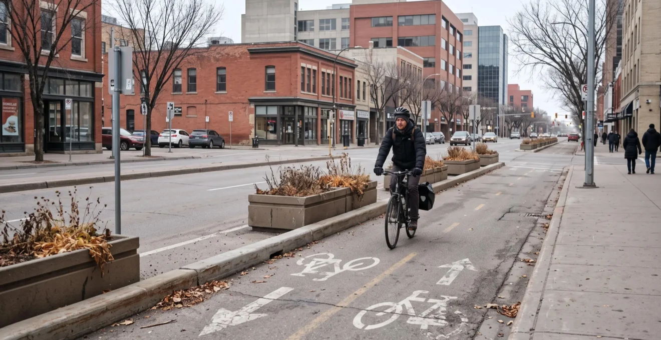
Winnipeg’s bike paths and walking trails can make everyday travel more practical by connecting neighbourhoods, workplaces, shops, schools, and transit stops without requiring a car for every journey. Their usefulness depends on more than the amount of infrastructure available. A comfortable path that ends at a difficult intersection may be less valuable for commuting than a continuous route combining several quieter streets.
The city offers different environments for active travel, from riverside pathways and neighbourhood streets to designated cycling facilities in the downtown area. Each serves particular journeys, and choosing between them requires attention to crossings, traffic, accessibility, and seasonal maintenance.
Winnipeg’s winters add another consideration. A route that works comfortably in July may require a substantial adjustment after snowfall or when daylight hours shorten.
For residents considering walking, cycling, or combining either with public transit, the most useful approach is to assess complete door-to-door journeys rather than individual trail sections. That makes it easier to identify routes that fit actual schedules, destinations, and comfort levels.
Making Winnipeg’s Active Transportation Network Work for Daily Trips
- Prioritize continuous routes with manageable crossings over isolated stretches of attractive cycling or walking infrastructure.
- Compare routes using traffic exposure, intersection design, lighting, travel time, and winter-maintenance priorities.
- Choose walking, cycling, transit, or a combination according to the complete journey, including parking, weather, and the return trip.
- Why Does Network Connectivity Matter for Winnipeg Bike Paths and Walking Trails?
- How Can You Plan a Safer Bike or Walking Route Across Winnipeg?
- Bike or Walk: Which Makes More Sense for Short Trips in Winnipeg?
- Route Planning Mistakes Winnipeg Cyclists and Pedestrians Should Avoid
- When Should Winnipeg Cyclists and Walkers Change Their Usual Route?
- Driving, Transit, or Active Travel: Which Works Best for Different Winnipeg Trips?
- Why Can Winnipeg’s Street Grid Make Some Detours Easier Than Others?
- How Does Winnipeg’s Transportation Network Keep People and Goods Moving?
Why Does Network Connectivity Matter for Winnipeg Bike Paths and Walking Trails?
Network connectivity determines whether Winnipeg residents can complete everyday journeys using comfortable walking and cycling routes instead of encountering unexpected gaps or hazardous crossings. A continuous corridor generally provides more practical value than several disconnected paths because it reduces route changes, difficult intersections, and reliance on busy roads. The entire journey matters, including access to the final destination.
A dedicated shared-use path separates users from ordinary motor-vehicle traffic along its length, although intersections and other conflict points still require attention. A connected neighbourhood-street route may offer a reasonable alternative, but its comfort depends on traffic conditions and the available crossings.
Neither route type guarantees a safe journey simply because it appears on a map.
Winnipeg’s Winnipeg’s 2024 Pedestrian and Cycling Strategies identify network expansion, improved sidewalks, barrier reduction, and stronger multimodal connections as strategic priorities. These directions recognize that isolated infrastructure cannot fully serve daily travel needs.
Consider several established corridors. The Northeast Pioneers Greenway provides a walking and cycling route between Gateway and Raleigh, from Knowles to Nairn. Assiniboine Parkway offers connections toward Charleswood Bridge and the St. James Overpass. Downtown cycling facilities serve a different concentration of destinations.
These corridors can form useful portions of a trip, but they should not be assumed to connect through protected infrastructure. Their suitability depends on the intermediate streets, intersections, and destination access points.
To assemble a complete route, mark the starting point and destination, identify usable path sections, then examine every connection between them. Check arterial crossings, including any necessary crossings of Portage Avenue or Pembina Highway, for designated facilities and manageable traffic conditions.
The City of Winnipeg trails and natural areas directory helps identify established trails, but it is not a substitute for a complete cycling-network map or a current conditions check.
Recreational quality and commuting usefulness are different tests. A scenic riverside route might provide a pleasant weekend outing while requiring a substantial detour to reach a supermarket or workplace.
For utility travel, assess whether the route reaches frequently visited destinations, has suitable crossings, and remains usable when needed. Winter maintenance is particularly important: a physically continuous route may become impractical when different segments receive different clearing services.
Once a potential connection is identified, the next challenge is choosing the version of that journey that offers the most suitable balance of safety, convenience, and reliability.
How Can You Plan a Safer Bike or Walking Route Across Winnipeg?
To plan a safer walking or cycling route in Winnipeg, start with the complete trip, identify designated active transportation infrastructure, and examine every major crossing. Compare traffic exposure, intersection design, lighting, and seasonal maintenance before choosing a route. Testing an unfamiliar journey during quieter conditions can reveal obstacles that digital maps do not show.
Begin by identifying the precise destination entrance rather than simply selecting the destination building. Access to a workplace, shopping centre, or transit station may differ considerably depending on which side of the property is accessible to pedestrians and cyclists.
Next, consult the City of Winnipeg’s cycling and active transportation mapping information to distinguish off-street pathways, neighbourhood greenways, painted cycling lanes, and physically protected facilities. Check whether the proposed route remains continuous or transfers onto ordinary streets.
At each intersection, evaluate the likely interaction with motor vehicles. Traffic speed, turning movements, signal arrangements, crossing distances, and visibility all matter. A modest detour to a better-controlled crossing may be preferable to a direct movement across a busy arterial road.
Seasonal conditions deserve separate attention. Dark winter commutes make street lighting, crossing visibility, and predictable surfaces more important. Snow-covered pavement markings and accumulated snow near intersections may also affect how easily travellers interpret the route.
Winnipeg’s City of Winnipeg active transportation snow-clearing priority map distinguishes pathways and sidewalks according to maintenance priorities. Under applicable Priority 1 operations, designated priority sidewalks and pathways are plowed within 36 hours after snowfall exceeding 5 cm. Priority 3 operations can involve a different threshold and a service period of up to five days after accumulation exceeding 8 cm.
These are service standards tied to applicable operations, not guarantees that an individual route will be clear or free of ice at a particular hour.
Three alternatives are worth comparing before committing to a regular journey.
| Route approach | Primary advantage | What to verify |
|---|---|---|
| Fastest | Potentially reduces total travel time | Traffic exposure, delays at crossings, and surface conditions |
| Safest-feeling | Prioritizes separation, low-traffic streets, and comfortable crossings | Connectivity, lighting, accessibility, and remaining conflict points |
| Best balance | Combines reasonable travel time with manageable risk and effort | Reliability during commuting hours and in different seasons |
The shortest geographic distance does not necessarily produce the shortest journey time. Repeated signal delays, inconvenient crossings, or poorly maintained connecting paths can make a slightly longer alternative more efficient.
Five Checks Before Using a New Winnipeg Route
- Mark the exact origin and destination entrance, producing a complete door-to-door route.
- Identify the infrastructure type along each segment, producing a marked route with potential gaps highlighted.
- List major intersections and crossing facilities, producing a short crossing-risk checklist.
- Check lighting and relevant winter-maintenance classifications, producing a seasonal route note.
- Test the route during a quieter period, producing a recorded travel time and a list of obstacles to address.
Once the route has been assessed, selecting the right travel mode becomes easier because the comparison is based on actual conditions rather than distance alone.
Bike or Walk: Which Makes More Sense for Short Trips in Winnipeg?
Walking generally makes more sense for very short Winnipeg trips with direct pedestrian access, while cycling becomes attractive when the journey is longer or walking would take substantially more time. Neither option wins at a universal distance. Bike parking, carrying requirements, weather, route conditions, and the effort involved at the destination can change the result.
The most practical comparison is total door-to-door time. Walking requires little preparation beyond suitable clothing and footwear. Cycling may reduce movement time but adds the effort of retrieving, locking, and storing a bicycle.
For example, a hypothetical resident travelling to a nearby pharmacy might find walking simpler because the destination is close and has a direct sidewalk approach. For a more distant grocery trip along a comfortable cycling corridor, a bicycle with suitable carrying equipment might be more convenient.
Carrying capacity should be evaluated realistically. A backpack or fitted panniers can make cycling useful for errands, but large purchases, awkward cargo, or missing secure parking may favour another travel mode. Walking can be simpler when carrying a small item or accompanying someone who does not cycle.
Winter can reverse a summer preference. Cycling may require additional clothing, suitable tires, more frequent cleaning, and greater attention to snow and ice. Walking can also become challenging when sidewalks are slippery, obstructed, or uncleared.
Route maintenance matters more than the calendar alone. A usable winter cycling corridor may remain practical for an experienced rider, while an unmaintained pathway can make the same journey unsuitable. Conversely, a cleared sidewalk and nearby destination may make walking a dependable winter choice.
Security is another factor. If a bicycle cannot be locked conveniently and securely at the destination, the time advantage of cycling may disappear. A well-positioned rack and a suitable lock can make a routine errand easier, but parking arrangements should be checked before the first trip.
Rather than setting a fixed distance threshold, compare the two modes using the same questions: How long is the complete trip? How much equipment is needed? Can the destination be reached comfortably? Will the return journey be equally manageable?
For either mode, a sound decision still depends on avoiding familiar planning errors that can turn a straightforward journey into an uncomfortable one.
Route Planning Mistakes Winnipeg Cyclists and Pedestrians Should Avoid
The most consequential route-planning mistakes in Winnipeg include following car directions without checking active transportation facilities, trusting automated map suggestions blindly, and overlooking winter conditions. Residents should also examine the return journey rather than assuming it will work like the outbound trip. Reviewing each segment helps uncover problems before they become part of a regular routine.
Driving directions are designed around motor-vehicle access and may favour arterials that do not offer a comfortable walking or cycling experience. A direct route along a busy corridor may require difficult intersections, long crossings, or cycling alongside substantial traffic.
Nearby residential streets, established paths, or different crossing points may provide a more suitable alternative. However, quiet streets should still be checked for continuity, intersection conditions, and their ability to reach the destination.
A suggested route is not a verified route. General navigation applications can be useful for estimating distance, but they may not accurately communicate the quality of cycling infrastructure, lighting, construction restrictions, or winter conditions. Compare their suggestions with municipal active transportation information and any relevant local notices.
Another frequent mistake is treating summer and winter travel as interchangeable. Ice accumulation near bridges, slushy approaches to intersections, and unmaintained connecting paths can change the difficulty of a familiar journey.
Before making a route part of a winter routine, identify whether each critical segment appears in the City’s priority maintenance system. Pay particular attention to connections between maintained facilities. A cleared main path is of limited use if the final approach remains blocked.
Planning only the outbound trip can introduce less obvious problems. The same streets may carry different traffic volumes later in the day. A journey completed in daylight may become less comfortable after dark, and Winnipeg’s open, exposed corridors can produce noticeably different experiences depending on wind direction.
Destination access also deserves attention. A route may end at a large parking lot without a convenient pedestrian entrance or secure bicycle parking. Check where the actual entrance, crossing, and parking facilities are located rather than assuming arrival at the property boundary completes the journey.
A practical safeguard is to review the route in both directions and under the conditions in which it will normally be used. Record difficult intersections, uncertain links, and any segments requiring a seasonal alternative.
Correcting these mistakes helps establish a usable route, but changing conditions mean even a well-tested journey should be reconsidered occasionally.
When Should Winnipeg Cyclists and Walkers Change Their Usual Route?
Winnipeg cyclists and pedestrians should reconsider their usual route when an intersection feels unsafe, construction changes access, seasonal conditions deteriorate, or a better connection becomes available. A serious hazard may justify an immediate change, while recurring inconvenience can be assessed over several trips. Keeping a tested alternative makes adjustments easier when conditions change unexpectedly.
A near-miss at an intersection deserves attention even if the traveller has used that crossing many times. Identify what contributed to the incident: turning vehicles, obstructed sightlines, unclear priority, excessive traffic exposure, or an unexpected conflict with another path user.
Do not assume one incident proves every alternative is safer. Instead, examine whether a nearby crossing offers more appropriate facilities and fewer conflict points. Repeated problems, however, are a strong reason to reconsider the existing route.
Construction is another clear trigger. Temporary closures can force pedestrians or cyclists toward unfamiliar roads, narrow passages, or crossings. When a usual segment is unavailable, follow applicable closure instructions and examine a complete replacement route rather than improvising at the obstruction.
Infrastructure changes can also justify a positive switch. A new cycling connection, improved crossing, or more direct pedestrian link may make a formerly inconvenient journey practical. Familiarity with the old route should not prevent considering an improved option.
A simple recurring audit can make the decision less subjective. Rate the usual route as acceptable, needing attention, or unsuitable in four categories: crossings, lighting, traffic behaviour, and maintenance.
Record the location of any recurring difficulty and the conditions under which it appears. For instance, a crossing might feel comfortable on a quiet weekend but become difficult during weekday commuting periods. A pathway could be useful through much of the year but unreliable following substantial snowfall.
Maintain at least one tested backup route where practical. A second option using different crossings or corridors can help during construction, poor weather, or unusual traffic conditions. Testing that option on a less time-sensitive journey reduces uncertainty.
For longer or more complex trips, a second backup may be useful, particularly when a river or railway crossing limits alternatives. The goal is not constant route switching but the ability to adapt without unnecessary disruption.
Once several workable routes are available, residents can also reconsider whether walking or cycling alone remains the best choice for each trip.
Driving, Transit, or Active Travel: Which Works Best for Different Winnipeg Trips?
The best transportation choice in Winnipeg depends on the specific trip rather than one mode being universally superior. Walking can simplify nearby errands, cycling can make moderate-distance journeys practical, transit can support longer trips, and driving may be useful for substantial cargo or difficult connections. Comparing total door-to-door time, cost, accessibility, and weather sensitivity produces a more useful decision.
Start by identifying the main constraint. For a short neighbourhood errand, parking a car may involve more effort than walking directly to the destination. For a longer commute, transit may be attractive if a convenient service connects the origin and destination. Cycling may offer useful flexibility where comfortable infrastructure and secure parking exist.
School journeys, grocery trips, and recreational outings involve different requirements. Accompanying children, travelling with mobility limitations, carrying heavy purchases, or needing a predictable arrival time can change which option works best.
Combining modes can solve problems that a single mode cannot. Walking to a transit stop may avoid a difficult cycling section. Cycling to a suitable transit connection can extend the reach of a bicycle trip without requiring the entire journey to be ridden.
Winnipeg Transit’s Bike & Bus service supports bicycle-and-bus journeys on select equipped vehicles during spring, summer, and fall. Front-mounted racks hold two bicycles and are available on a first-come, first-served basis without an additional rack fee beyond the regular fare.
The service assigns equipped buses first to the BLUE rapid transit line and elsewhere as available. The Winnipeg Transit app and Navigo can identify equipped buses for same-day trip planning. Because availability is limited, travellers should have an alternative if a rack is unavailable.
Bike lockers at Southwest Transitway rapid transit stations, Osborne Junction, and Taylor Park & Ride provide another way to combine cycling and transit, subject to applicable access arrangements.
Driving part of a journey and walking the final section may also be reasonable when parking arrangements and pedestrian access support that choice.
Cost comparisons require care. Car travel involves more than fuel, including ownership, maintenance, insurance, and parking. Cycling involves equipment, upkeep, and sometimes secure storage. Transit has fares, while walking and cycling may involve additional time or preparation.
Compare the resources actually used by each journey. A car already owned for other purposes presents a different immediate trip decision from the broader question of whether a household needs a vehicle at all.
Mode choices should be reconsidered when a workplace moves, a transit route changes, cycling infrastructure improves, or a household’s needs shift. A preferred mode for one trip need not become a rule for every trip.
Where walking or cycling remains appropriate, Winnipeg’s residential street pattern can provide additional ways to avoid unsuitable road sections.
Why Can Winnipeg’s Street Grid Make Some Detours Easier Than Others?
Winnipeg’s residential street grid can make detours practical because parallel streets sometimes provide alternatives to busy arterial roads. A slightly longer journey through quieter blocks may involve more comfortable walking or cycling conditions. However, rivers, railway corridors, and large properties interrupt the grid, making certain bridges, intersections, and underpasses essential connections that cannot always be bypassed.
On a map, a major road often appears to be the most direct route. Travellers should also examine residential streets one or two blocks away to see whether they provide a usable parallel connection.
The benefit is not simply lower traffic exposure along those streets. A connected sequence of residential blocks may also lead to an intersection with more suitable crossing facilities or better access to a destination.
However, a quiet street is not automatically a continuous route. It may terminate at a railway line, riverbank, commercial property, or road without a convenient crossing. A detour that appears promising in one neighbourhood can become unnecessarily long if the next connection is unavailable.
Winnipeg’s Red and Assiniboine rivers are particularly important geographical constraints. The number and placement of crossing opportunities influence how residents can travel between nearby areas. Rail infrastructure and large land parcels create similar interruptions elsewhere.
Where a bridge or underpass supports multiple travel modes, it can provide a valuable connection between otherwise separated parts of the network. Conversely, a temporary closure at an important crossing may require a substantial change in route.
Consider a hypothetical commuter whose direct arterial journey involves several uncomfortable intersections. Looking at parallel residential streets might reveal a quieter alternative that reconnects near a suitable crossing. But the option only works if the streets remain connected across every barrier and the final approach is usable.
To find such alternatives, start with the direct route and scan two or three blocks to either side. Trace each possible parallel street to the next major barrier. Mark confirmed crossing points and check whether the route reconnects without requiring a difficult or prohibited movement.
Compare the alternatives using total travel time, crossings, surface conditions, and accessibility. The most useful detour is not necessarily the quietest individual street but the one that offers a manageable complete journey.
Understanding these local street patterns becomes even more useful when they are considered alongside the wider transportation network and its maintenance priorities.
Key Takeaways for Everyday Travel Decisions
- Think of each regular trip as a chain of connections: sidewalks, paths, crossings, transit links, and destination access must all work together.
- Use local streets to improve route flexibility, but identify river, railway, and major-road crossings before choosing a detour.
- Match the journey to current conditions and maintenance priorities rather than assuming the same route or travel mode is always appropriate.
How Does Winnipeg’s Transportation Network Keep People and Goods Moving?
Winnipeg’s transportation network works through several connected systems: roads carry private vehicles, freight, and buses; transit links destinations across the city; and sidewalks, cycling facilities, and shared-use paths support travel without a car. These systems complement one another. Everyday mobility improves when residents understand how to connect them and choose the appropriate infrastructure for each journey.
Major roads perform important functions for vehicle movement, deliveries, transit services, and access to commercial areas. Their role does not necessarily make them the most comfortable choice for walking or cycling, particularly where traffic volumes, speed, or crossing arrangements create difficulties.
Local streets serve neighbourhood access and can sometimes support useful active transportation connections. Sidewalks provide pedestrian access, while dedicated and shared-use pathways offer different opportunities for walking and cycling. Public transit links destinations beyond comfortable walking distances and can form part of journeys that begin or end on foot or by bicycle.
Reading the network as layers helps clarify choices. For each regular trip, identify the main corridor, the local connections leading to it, and the infrastructure needed to reach the final destination.
A resident might walk along neighbourhood sidewalks to a bus stop, take transit for the longest part of the journey, and walk the remaining distance. Another might cycle along a shared-use path, continue through quieter streets, and finish at secure bicycle parking.
Both examples demonstrate why the usefulness of the network depends on connections between travel modes, not simply the number of roads, paths, or transit routes available.
Winter maintenance adds another layer. Winnipeg distinguishes infrastructure through street and active transportation snow-clearing priorities. Higher-priority facilities may receive service under different thresholds and timelines than lower-priority routes, depending on the operation being conducted.
This means that an important road, a priority active transportation pathway, and a lower-priority neighbourhood sidewalk can have different conditions following the same snowfall. Maintenance priority helps residents anticipate potential differences, although observed conditions still need to be checked.
The network also changes. Roadwork, infrastructure improvements, transit service revisions, and seasonal restrictions may affect connections that have previously worked well.
For practical planning, keep a simple record of frequently used destinations and identify the walking, cycling, transit, and driving options available for each. Include a preferred route, an alternative, and any conditions that would justify switching modes.
Choose one familiar destination, compare its complete travel options, and test an appropriate alternative under comfortable conditions. A small improvement in a route used regularly can make everyday movement through Winnipeg more convenient and predictable.
Are all Winnipeg bike paths maintained during winter?
No. Winnipeg uses different maintenance priorities for sidewalks and active transportation pathways. Enhanced service applies to designated priority facilities, while other routes may have different clearing thresholds and timelines. Check the City’s maintenance classification and current conditions before relying on a particular route in winter.
Can pedestrians and cyclists use the same trails in Winnipeg?
Many Winnipeg pathways accommodate both walking and cycling, including routes identified by the City as shared walking and biking facilities. However, permitted uses can differ by location. Check posted signs and applicable restrictions, and allow appropriate space when passing other trail users.
What should someone do if a cycling route ends at a busy road?
Identify a suitable designated crossing and examine whether a nearby street or pathway offers a more comfortable connection. Avoid assuming that the direct continuation is appropriate simply because a route-planning application recommends it. Review the full alternative before travelling.
Can a bicycle be taken on Winnipeg Transit buses?
Select Winnipeg Transit buses provide front-mounted racks during spring, summer, and fall. Each rack carries two bicycles, with space available on a first-come, first-served basis. Travellers can check the Transit app or Navigo for bike-rack-equipped buses when planning a same-day journey.
How can residents tell whether a familiar route is still suitable?
Review difficult crossings, changes in traffic behaviour, lighting, surface conditions, construction, and winter maintenance. Record recurring obstacles and compare at least one alternative. A route that was comfortable in summer or under previous traffic conditions may need adjustment as circumstances change.