Transportation and Infrastructure
Every time you drive down Kenaston Boulevard, catch a bus on Portage Avenue, or turn on a tap in your kitchen, you are relying on a vast, mostly invisible network: transportation and infrastructure. These systems are the skeleton of a city — much like bones in a body, they go largely unnoticed when healthy, but any weakness is felt immediately by everyone. For Winnipeggers, understanding how these systems work is not just an academic exercise; it shapes commutes, property values, city budgets, and quality of life on the Prairies.
This pillar page serves as a complete introduction to transportation and infrastructure, with a focus on how these concepts apply in Winnipeg and across Canada. Whether you are a newcomer, a curious resident, or someone beginning to dig into civic issues, this resource will give you the foundation to understand the subject with confidence.
What Is Transportation and Infrastructure?
At its simplest, infrastructure refers to the physical systems a community needs to function. Think of it as the plumbing, wiring, and roadways of civilization. Transportation infrastructure is the subset dedicated to moving people and goods: roads, bridges, railways, airports, bus systems, and bike paths. Broader infrastructure also includes water treatment plants, storm sewers, power grids, and telecommunications.
A helpful way to visualize the relationship is a two-layer model:
- Hard infrastructure: the physical assets — asphalt, concrete, steel, pipes, and vehicles.
- Soft infrastructure: the institutions that manage them — transit agencies, public works departments, planning boards, and maintenance schedules.
Both layers must work together. A brand-new fleet of buses is useless without trained operators, routes, and maintenance garages. This interplay is why infrastructure planning is one of the most complex jobs any municipal government undertakes.
Why Infrastructure Matters in Winnipeg’s Climate
Winnipeg is a particularly instructive place to study infrastructure because of its extreme climate. Sitting in one of the coldest major cities in the world, Winnipeg endures temperature swings from well below -30°C in winter to above +30°C in summer. This freeze-thaw cycle is brutal on pavement and pipes.
Water expands when it freezes. When moisture seeps into small cracks in a road, freezes overnight, and thaws by afternoon, it wedges the crack wider — a process repeated hundreds of times each season. The result is the familiar pothole, a problem so widespread in Winnipeg that it has become a cultural talking point as much as a maintenance issue. The City’s public works department fills thousands of potholes each spring, and the annual repair budget is a recurring debate at City Hall.
Similarly, water mains in Winnipeg have historically been made of materials vulnerable to cracking in deep frost, leading to service disruptions when lines freeze during cold snaps. These realities make infrastructure maintenance a year-round, high-priority activity here in a way that milder climates rarely experience.
The Main Components of Urban Transportation
To navigate discussions about local development, it helps to know the major pieces of the transportation puzzle:
Roads and Bridges
Winnipeg sits at the junction of the Red and Assiniboine rivers, which means bridges are essential connectors. The city maintains dozens of river crossings and overpasses, and their condition — inspected and rated regularly — directly affects traffic flow between neighbourhoods on either side of the rivers. Major arterial routes like Route 90, Lagimodière Boulevard, and the perimeter highway (Provincial Road 100) form the backbone for vehicles, while an extensive grid of residential streets handles local access.
Public Transit
Winnipeg Transit operates the city’s bus network, connecting residential areas to downtown, post-secondary institutions, and employment hubs. Transit planning involves balancing route coverage (serving as many people as possible) with frequency (minimizing wait times). Winnipeg has also invested in bus rapid transit corridors along the Southwest Transitway, a dedicated bus roadway designed to bypass congestion — an analogy would be giving buses their own private lane on a highway so they never get stuck in traffic.
Cycling and Pedestrian Networks
Bike lanes, multi-use paths, and walkable streets are increasingly recognized as legitimate transportation infrastructure, not just recreation. Winnipeg’s riverside pathways and expanding bike network offer alternatives to driving, reduce congestion, and improve public health. Winter maintenance of these routes remains an evolving challenge.
Rail, Air, and Freight
Winnipeg’s identity as the Gateway to the West is rooted in freight. The city is a major national rail hub, home to large intermodal terminals where shipping containers transfer between trains and trucks. Winnipeg Richardson International Airport adds an air cargo dimension, and CentrePort Canada, the country’s largest inland port, ties all these modes together. Freight infrastructure is often invisible to commuters but is a cornerstone of the regional economy.
How Infrastructure Projects Are Planned and Funded
Understanding the life cycle of an infrastructure project demystifies why repairs seem slow and why costs are high. A typical project follows these stages:
- Needs assessment: engineers and planners identify problems — a deteriorating bridge, a congested intersection, an underserved neighbourhood.
- Study and design: options are evaluated for cost, environmental impact, and long-term benefit. Public consultations gather resident feedback.
- Funding approval: budgets are set, often blending municipal tax revenue with provincial and federal cost-sharing programs.
- Procurement and construction: contractors are selected through competitive bidding, and work is scheduled to minimize disruption — often concentrated in Winnipeg’s short summer construction season.
- Maintenance and monitoring: the asset enters an ongoing cycle of inspection and repair that lasts decades.
This process explains a common frustration: infrastructure moves slowly because the stakes are enormous. A poorly designed road or water system locks a city into decades of costs. Patience in planning is, in effect, an investment in avoiding far more expensive fixes later.
The Challenge of Aging Assets and the Infrastructure Deficit
Like most Canadian cities, Winnipeg faces a gap between the cost of maintaining existing infrastructure and the revenue available to pay for it — often called the infrastructure deficit. Much of the city’s underground network of water and sewer pipes was laid generations ago and is approaching the end of its design life.
A useful analogy: infrastructure is like a household appliance. Even a well-built refrigerator eventually needs replacing, and if you defer the purchase too long, you face an emergency breakdown plus water damage. Cities that invest steadily in renewal avoid the catastrophic-failure scenario; cities that defer accumulate risk.
Concretely, this deficit shows up locally as:
- Water main breaks and road collapses during winter and spring thaw.
- Backlogs of street resurfacing and sidewalk repairs.
- Difficult trade-offs between building new suburban infrastructure and renewing existing core neighbourhoods.
Emerging Trends Shaping the Future
Several developments are transforming how cities like Winnipeg approach transportation and infrastructure:
Electrification
Electric vehicles are shifting demand: cities are installing public charging stations, and transit agencies are piloting electric buses that perform in cold climates. Electrification touches infrastructure far beyond transportation, since the electrical grid must grow to support it.
Climate Adaptation
More intense storms and variable weather are pushing engineers to design for resilience — larger stormwater capacity, flood-resistant designs near the Red River (a lesson cemented by past major floods), and materials better suited to freeze-thaw cycles.
Data-Driven Management
Sensors, GPS-fitted vehicles, and asset-management software now let cities track pavement condition, transit ridership, and water usage in near real time, directing maintenance dollars where they matter most.
How Residents Can Engage
Infrastructure is ultimately a public asset, and informed residents shape its direction. Here are practical ways to participate:
- Follow city budget discussions: infrastructure spending is one of the largest line items, and public input is part of the process.
- Report problems: potholes, broken streetlights, and damaged sidewalks can typically be reported through the City’s service channels, feeding directly into maintenance priorities.
- Participate in consultations: major projects — transit corridors, bridge renewals, bike networks — hold public engagement sessions where resident feedback genuinely influences design.
- Think long-term: evaluate proposals not just by immediate cost, but by durability, accessibility, and community benefit over decades.
Key Takeaways
Transportation and infrastructure form the interconnected systems that make daily urban life possible. In Winnipeg, the harsh climate, river geography, and freight heritage create a distinctive infrastructure profile with unique challenges and opportunities. Understanding how roads, transit, water systems, and planning processes fit together empowers residents to navigate civic debates, make smarter personal choices, and appreciate the enormous — often unseen — effort behind every smooth commute and clean glass of water.
Use this page as your starting point, and continue to the topic-specific articles in this category for deeper dives into each element of the system.
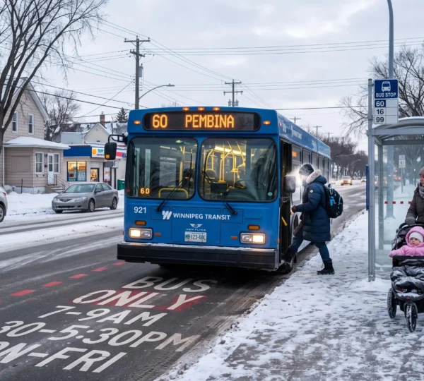
Which Winnipeg Transit Projects Can Make Daily Travel More Reliable?
A transit investment can shorten a bus journey without making the entire trip more dependable. For Winnipeg riders, the meaningful test is whether buses arrive predictably, transfers work and services remain useful during winter, evenings and weekends. Winnipeg’s Transit Master…
Read more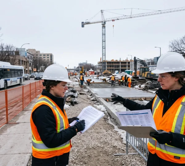
How Do Funding Agreements Move Major Winnipeg Infrastructure Projects Forward?
Major infrastructure projects in Winnipeg often depend on more than a City Council decision or a single government announcement. Replacing essential wastewater facilities, expanding rapid transit, and renewing major transportation corridors can require capital investments beyond what municipal revenues can…
Read more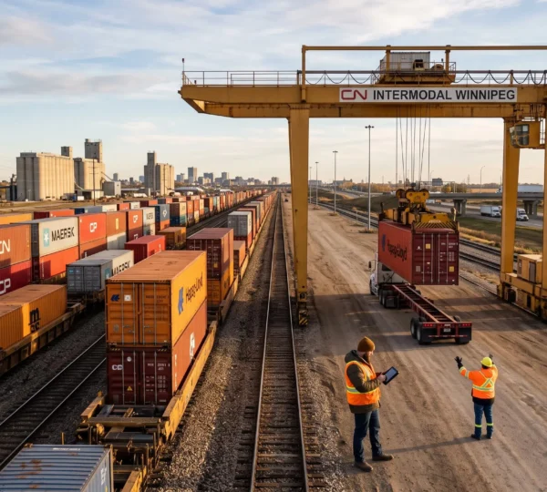
Why Is Winnipeg a Major Transportation and Logistics Hub for Central Canada?
Winnipeg is a major transportation and logistics hub because several important Canadian freight networks intersect in and around the city. East–west railway corridors, the Trans-Canada Highway system, north–south connections to the United States and international air cargo services provide businesses…
Read more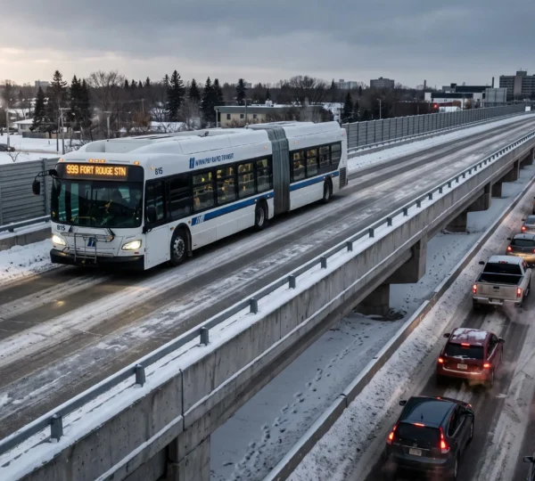
How Do Rapid Transit Corridors Change the Way Winnipeg Riders Travel?
Winnipeg rapid transit corridors change how riders travel by separating important portions of bus journeys from regular traffic and connecting those faster segments to neighbourhood routes. The biggest advantage is not necessarily a higher maximum speed. It is the possibility…
Read more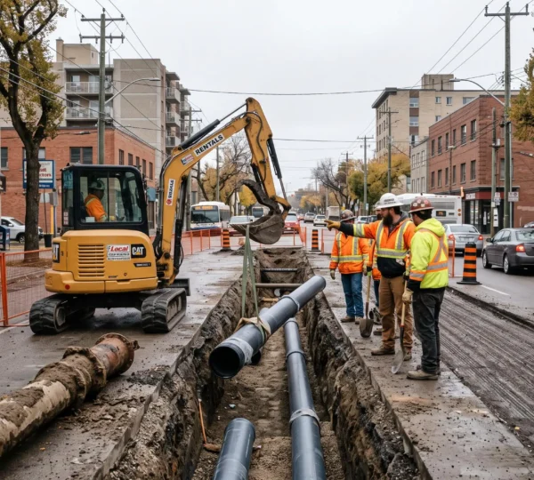
How Does Long-Term Infrastructure Planning Prepare Winnipeg for Future Growth?
Winnipeg cannot prepare for future growth simply by expanding roads, adding transit capacity or constructing new facilities. The city must also maintain thousands of existing infrastructure assets, many of which will require substantial investment before they reach the end of…
Read more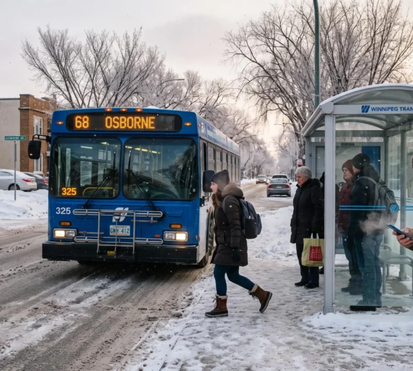
How Can Winnipeg’s Public Transit System Better Serve Everyday Trips?
Winnipeg’s public transit system can better support everyday travel when residents can rely on understandable routes, manageable transfers, predictable arrival times, and accessible connections. For someone travelling to work, attending classes, collecting a child, or reaching a medical appointment, the…
Read more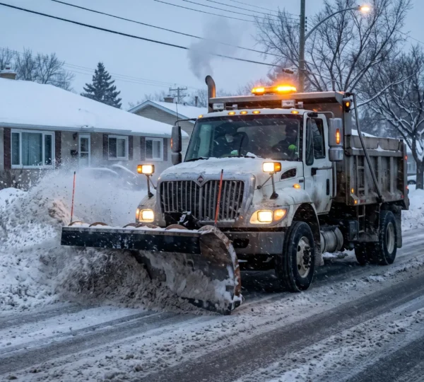
How Do Winnipeg Snow Clearing Operations Restore Streets After Major Snowfall?
Winnipeg restores winter mobility through a staged snow-clearing system that puts major roads, bus routes and essential access corridors ahead of residential streets. After a significant snowfall, crews concentrate first on keeping the transportation network functioning. Neighbourhood plowing follows once…
Read more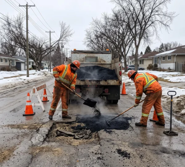
How Does Winnipeg Road Maintenance Respond to Seasonal Street Damage?
Winnipeg road maintenance responds to seasonal street damage through a combination of pothole patching, pavement inspections, snow clearing, planned resurfacing, and long-term reconstruction. The treatment depends on weather conditions, traffic importance, pavement deterioration, and available infrastructure funding. Immediate safety hazards…
Read more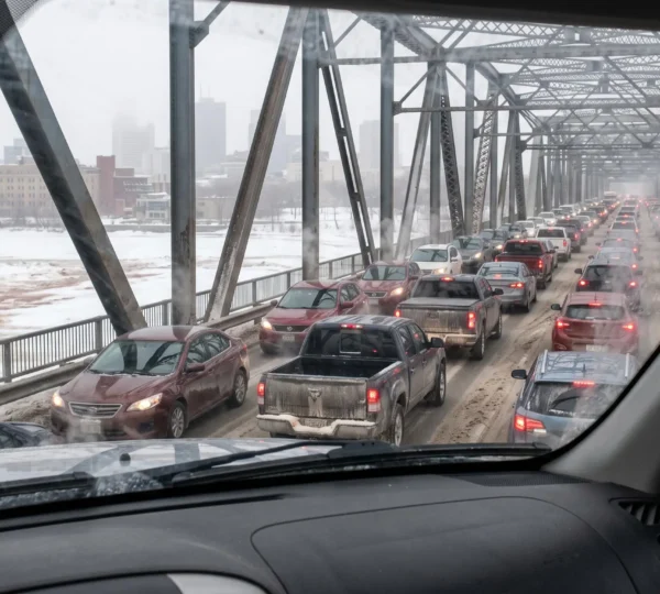
How Can Winnipeg Commuters Reduce Delays During Peak Travel Hours?
Winnipeg commuters can reduce peak-hour delays by identifying their most unpredictable bottlenecks, comparing alternative departure times, preparing a reliable backup route, and checking current conditions before leaving. The objective is not necessarily to achieve the shortest possible journey every morning….
Read more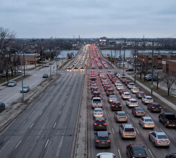
How Do Winnipeg’s Key Arterial Routes Shape Cross-City Travel?
Winnipeg’s major arterial roads connect neighbourhoods with downtown, employment districts, shopping areas and destinations across the city. Corridors such as Kenaston Boulevard, Pembina Highway and Henderson Highway carry substantial cross-city demand because they provide continuity that smaller streets cannot always…
Read more