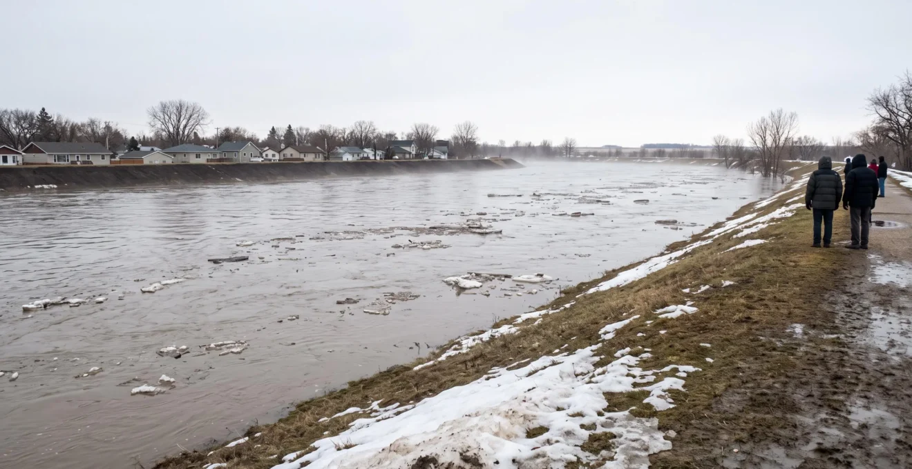
Red River spring flooding affects Winnipeg through rising river levels, possible overland flooding, pressure on flood-control infrastructure and disruptions to transportation. Even when the river remains within its banks, melting snow, saturated ground and overwhelmed drainage systems can cause water damage in neighbourhoods far from the river.
The severity of each spring depends on conditions across the wider Red River basin, including winter snow accumulation, soil conditions, spring rainfall and the speed of snowmelt. Winnipeg benefits from major flood-control infrastructure, but that protection does not eliminate every risk to individual properties or surrounding communities.
For residents, preparation starts with understanding which type of flooding could affect their home. Checking drainage equipment, reviewing insurance coverage, documenting belongings and following provincial forecasts can make a practical difference before conditions deteriorate. Knowing which roads may close and how to respond to local warnings is equally important.
Red River spring flooding in Winnipeg: What residents need to know
- Flood risk changes each spring. Snowpack, frozen ground, spring rain and melt timing influence river levels, while flood-control infrastructure reduces Winnipeg’s exposure.
- Not all spring flooding comes from the river. Surface water accumulation and sewer backup can damage homes throughout Winnipeg, including properties outside river flood-prone areas.
- Prepare before warnings escalate. Inspect drainage systems, confirm insurance coverage, make an emergency plan and monitor official Manitoba forecasts and local advisories.
- Why Does Red River Flood Risk Change So Much From One Spring to Another?
- How Can Winnipeg Residents Prepare Before Red River Flood Risk Increases?
- River Flooding or Local Water Buildup: Which Risk Is Affecting Your Winnipeg Area?
- Spring Flood Preparation Mistakes Winnipeg Households Should Avoid
- When Should Winnipeg Residents Start Monitoring Red River Flood Conditions?
- How Can Winnipeg Travellers Adapt When Their Usual Route Is Disrupted?
- Infrastructure Planning Mistakes That Can Create Bigger Problems for Winnipeg Later
- How Does Long-Term Infrastructure Planning Prepare Winnipeg for Future Growth?
Why Does Red River Flood Risk Change So Much From One Spring to Another?
Red River flood risk varies from spring to spring because snow accumulation, ground conditions and melting weather rarely follow the same pattern twice. A snowy winter does not automatically produce major flooding. The amount of water stored in the snowpack, how much the ground can absorb and whether rainfall accelerates melting determine how much runoff reaches the river.
Three interacting conditions are particularly important:
- Snow water equivalent: This measures the water contained in accumulated snow across the drainage basin. A deep snowpack does not necessarily contain the same amount of water as an equally deep but denser snowpack.
- Soil moisture and frost depth: Already saturated or frozen ground may absorb less meltwater, increasing surface runoff. Drier ground and shallower frost can sometimes allow more infiltration.
- Melt timing and spring precipitation: A gradual thaw may spread runoff over time, while rapid warming combined with rainfall can send substantial water into streams and tributaries over a shorter period.
These factors help explain why conditions throughout the basin matter more than the appearance of snow within Winnipeg alone. Runoff entering the Red River from upstream areas can influence water levels farther north, while ice conditions can create additional localized complications.
In Manitoba’s February 2026 spring flood outlook, the Hydrologic Forecast Centre identified a moderate spring flood risk for the Red River. The assessment emphasized that additional snowfall, spring rainfall and the timing and rate of snowmelt could change conditions. That historical outlook was not a guarantee of flooding at any particular property, nor should it be used as a forecast for a subsequent spring.
The geography of the Red River Valley adds another challenge. Its relatively flat landscape means that once water overtops natural banks or local protection, a relatively small increase in river level can spread across a much larger horizontal area. The difference between two forecast crests may therefore have substantial implications for low-lying land.
Winnipeg’s exposure also depends on flood-control infrastructure. The Red River Floodway diverts part of the river’s flow around the city when operated, while dikes provide more localized protection. The Shellmouth Dam and Portage Diversion manage components of the Assiniboine River system rather than directly controlling upstream Red River flows.
Residents should distinguish a seasonal flood outlook from a forecast crest. An outlook assesses developing risk, while a crest forecast estimates the expected peak river level at a particular location, subject to revision. Flood stage or local protection levels provide the context needed to understand the significance of that peak.
Provincial Hydrologic Forecast Centre bulletins provide the main basis for interpreting these indicators. Environment and Climate Change Canada weather forecasts add information about approaching precipitation and temperature changes, but do not replace provincial river-level forecasts.
Because the forecast can change as runoff develops, household preparation should be completed before a particular crest becomes the focus of public attention.
How Can Winnipeg Residents Prepare Before Red River Flood Risk Increases?
Winnipeg residents can prepare for spring flooding by documenting their property, understanding its flood exposure, checking household drainage systems and reviewing insurance before snowmelt begins. An effective plan distinguishes protection provided by the municipality from measures homeowners must maintain themselves. Preparation should also include emergency supplies, reliable warning channels and a realistic evacuation arrangement.
The first step is establishing the property’s exposure. Living near the Red River does not automatically mean a home is unprotected, and living farther away does not guarantee freedom from flooding. Residents can contact the City of Winnipeg to understand applicable flood protection levels, local dike arrangements and any property-specific floodproofing requirements.
Where elevation information is needed, obtain a reliable property survey or professional assessment rather than estimating elevation from surrounding streets. Confirm whether permanent works protect the property and whether temporary measures might be required during an unusually high-water event.
Homeowners should also photograph basement contents, important equipment and valuable belongings. An updated inventory, supported by photographs and receipts where available, provides useful documentation if water damage occurs.
Municipal and individual responsibilities differ. The city and province manage public flood-control operations, relevant protective works and emergency communications. Depending on the event, municipal operations may include temporary dikes or sandbag arrangements. Residents should follow announcements rather than assume that sandbags or temporary protection will be available at a particular location.
At the property level, attention should go to downspouts, foundation drainage, sump pumps and backwater valves. These measures address problems that public river-control structures cannot solve inside an individual home.
Insurance deserves particular attention. Standard Canadian home insurance policies typically do not automatically cover overland flooding or sewer backup. These risks may require optional endorsements, and eligibility, deductibles and exclusions vary with the property and insurer. Confirm the exact wording of the policy and obtain written clarification before the risk increases.
A household emergency plan should identify where family members will meet, how they will communicate, which essential documents and medications must be accessible and where they could stay if evacuation becomes necessary. Include pets, mobility needs and a portable emergency kit. Follow City of Winnipeg and Manitoba Emergency Management information for applicable alerts and preparedness guidance.
Five spring flood preparation actions to complete
- Photograph the home’s exterior, basement equipment and major belongings; save a dated photo folder and property inventory.
- Check municipal flood information and any available property survey; record whether the property needs further elevation or floodproofing assessment.
- Inspect drainage outlets, downspouts, sump equipment and backwater valves; keep a dated maintenance record and arrange professional work where necessary.
- Ask the insurance provider to confirm overland flood and sewer-backup protection; retain a written summary of coverage, exclusions and deductibles.
- Prepare an emergency kit, communication plan and possible evacuation destination; save a household plan containing contacts and official alert sources.
Once those preparations are complete, the next priority is identifying which kind of water intrusion is most plausible, since river flooding and neighbourhood drainage problems require different responses.
River Flooding or Local Water Buildup: Which Risk Is Affecting Your Winnipeg Area?
Winnipeg residents may face river overflow, accumulated surface water or wastewater backing up through household sewer connections. These problems can occur separately or together, but their causes and protective measures differ. The water’s entry point, nearby conditions and official flood advisories help identify the likely problem. A property does not need to border the Red River to experience serious spring water damage.
When river levels rise beyond surrounding banks or flood protection, water may spread across nearby land. This is a river-related overland flooding hazard. The exposure depends on local elevation, protective structures and the level of the water.
Urban surface water accumulation occurs when melting snow or rain collects faster than it can drain away. Frozen ground, saturated soils, blocked drainage paths and depressions around buildings can contribute. Water may enter through exterior doors, window wells or foundation openings even where the Red River presents no direct threat.
Sewer backup is different. When wastewater or combined sewer systems become overwhelmed, water can return through basement drains or plumbing connections. The City of Winnipeg identifies both basement and overland flooding as risks that can affect homes throughout the city.
The distinctions are useful when deciding what protection to prioritize.
| Risk and warning signs | Likely cause | Relevant protection |
|---|---|---|
| River-related overland flooding: rising nearby river levels, water spreading across low-lying land | River overflow or water reaching areas beyond available flood protection | Municipal dikes, approved temporary barriers, property floodproofing and evacuation planning |
| Local surface water accumulation: pooling around foundations, driveways or window wells | Rapid snowmelt, rainfall, poor grading, frozen ground or restricted surface drainage | Clear drainage routes, suitable lot grading and safe diversion of water away from buildings |
| Sewer backup: wastewater emerging through basement plumbing or floor drains | Overloaded sewer infrastructure or restricted drainage connections | Properly installed and maintained backwater valves, appropriate drainage systems and qualified plumbing assessment |
Misidentifying the problem can lead to ineffective spending. Sandbags intended to interrupt surface flow will not necessarily prevent wastewater from entering through a sewer connection. Similarly, a backwater valve does not stop river water or surface runoff from entering through an exterior opening.
The City of Winnipeg guidance on basement and overland flooding explains these household risks and identifies drainage and backwater-protection measures that residents can maintain.
Insurance classification is another reason to identify the water source carefully. Overland flood protection and sewer-backup coverage are often sold as distinct optional forms of protection, although some insurers combine them. The Insurance Bureau of Canada explains these differences in its guidance on flood and water damage.
For example, imagine a Winnipeg home several kilometres from the Red River where melting snow pools against a basement window. Even without a river flood warning, the home could experience overland water entry. A different property might remain dry outside but experience wastewater entering through a floor drain. The appropriate prevention and insurance questions would differ.
After water damage, take photographs where it is safe, document the apparent entry point and contact the insurer promptly. Avoid contact with contaminated water or submerged electrical equipment. The insurer, and where necessary a qualified professional, can assess the cause; visual clues alone do not determine coverage.
Once the likely exposure is understood, homeowners can avoid several preparation mistakes that sometimes increase the consequences of spring flooding.
Spring Flood Preparation Mistakes Winnipeg Households Should Avoid
Common flood preparation mistakes in Winnipeg include waiting too long to arrange barriers, placing sandbags incorrectly, obstructing household drainage and assuming every type of water damage is insured. Another serious error is ignoring official flood warnings because the river appears calm. Effective preparation depends on early action, appropriate protection methods and a clear understanding of each system’s limitations.
Waiting until the expected crest approaches leaves little time to assemble temporary defences. Sandbags require sufficient materials, labour and a suitable layout. They must be arranged to limit water passing through gaps and around the ends of the barrier. Poorly supported or incorrectly positioned walls may fail under water pressure.
Residents should not improvise major dikes where structural stability, foundations, neighbouring drainage or public infrastructure could be affected. Follow municipal instructions and obtain qualified advice when the proposed barrier involves significant water depth or loads.
Blocking openings without considering drainage creates another problem. An improvised basement-door barrier might reduce water entering from outside while trapping water that already collects behind it. Likewise, redirecting runoff toward a window well, adjacent property or sump discharge area may create a new hazard.
Before altering drainage or building barriers, identify where water is expected to collect and how it can be removed safely. A sump pump is useful only when its discharge has a suitable outlet and its installation is appropriate to the home’s drainage system. A backup power arrangement may be worth discussing with a qualified installer.
Assuming all flood damage is insured can produce financial surprises. Policies may distinguish between overland water, sewer backup and other sources of leakage. Coverage availability may also depend on the property’s assessed risk. A written confirmation of endorsements, exclusions and limits is more useful than a general assumption that the home is insured against flooding.
Finally, river appearance should not override official warnings. Runoff from upstream areas, tributary inflows and changing ice conditions can affect flood forecasts without creating an obvious immediate change beside a particular home. Residents should respect municipal evacuation notices, road closures and emergency directions.
These precautions also have limits. Routine property maintenance cannot prevent every extreme flood, and temporary barriers should never be treated as a reason to remain in an unsafe location after authorities advise evacuation.
The most practical way to avoid last-minute decisions is to establish a monitoring routine before the spring melt begins and adjust it as forecasts become more specific.
When Should Winnipeg Residents Start Monitoring Red River Flood Conditions?
Winnipeg residents should begin monitoring Red River flood conditions in late winter, before widespread snowmelt begins. Provincial seasonal outlooks provide an early indication of basin-wide risk, while more frequent monitoring becomes important during the spring thaw, often in March and April. Once river crest forecasts or local flood advisories are issued, residents should check official updates regularly and respond to changes promptly.
Monitoring should follow the progression from winter conditions to active runoff rather than rely on a single forecast. The exact timing varies each year, and flooding can develop outside the most familiar seasonal window.
| Period | Information to follow | Useful household response |
|---|---|---|
| Late winter, before widespread melting | Snow water equivalent, soil moisture, frost conditions and provincial seasonal outlooks | Review exposure, inspect drainage equipment and confirm insurance |
| March and April, as thaw conditions develop | Updated outlooks, spring precipitation, temperature changes and river forecasts | Increase monitoring and check emergency supplies and travel alternatives |
| When crest forecasts or flood advisories are active | Projected water levels, revised crest timing, municipal notices and road closures | Follow official protective instructions and prepare to alter travel or evacuate if directed |
| After the peak | River recession, remaining floodwater, local access restrictions and drainage conditions | Maintain precautions until local authorities confirm conditions are safe |
The Manitoba Hydrologic Forecast Centre is the key provincial authority for flood outlooks and hydrologic forecasting. Its reports help residents understand the wider basin and the potential severity of spring runoff. Environment and Climate Change Canada forecasts provide additional context about weather conditions capable of changing that outlook.
City of Winnipeg operational announcements serve a different purpose. They address local protective actions, temporary works and neighbourhood-specific instructions. These notices may be issued closer to the time when action becomes necessary, making them especially important during an active flood response.
Three indicators are worth understanding. Snow water equivalent describes the water stored in the snowpack. Soil moisture and frost conditions influence infiltration and runoff. A forecast crest estimates the highest river level expected at a specified location during an event, whereas a flood stage or protection level helps explain what that forecast could mean locally.
Residents should not compare river readings from different locations or reference systems without checking whether the values are directly comparable. A crest forecast for one monitoring station does not automatically establish the elevation or safety of an individual property.
Seasonal outlooks are inherently uncertain. New precipitation, changes in thaw speed and ice conditions can alter projections. A low early outlook is not a reason to neglect routine preparation, just as a higher preliminary assessment does not prove that a particular home will flood.
For an active event, review provincial flood bulletins, Winnipeg public notices and the relevant local emergency authority’s messages. Save or bookmark the official channels in advance, and use any notification subscription or alert registration options they currently provide. Check updates more frequently when conditions are changing rapidly or protective action may be required.
Those same updates are essential for travel decisions because even a property unaffected by flooding may depend on roads or services disrupted by spring runoff.
How Can Winnipeg Travellers Adapt When Their Usual Route Is Disrupted?
Winnipeg travellers should adapt to spring flooding by checking road conditions before departure, identifying a verified alternative route and allowing for sudden closures. Routes through low-lying areas of the Red River Valley can become impassable when floodwater covers roads or temporary protection is installed. Drivers must never enter a flooded roadway, regardless of how shallow the water appears.
Travel disruptions are particularly relevant on rural roads and highways south and east of Winnipeg, where the flat valley landscape contains low-lying road sections and river crossings. The specific roads affected depend on the flood event, local drainage, protection measures and official closure decisions.
Connections between Winnipeg and nearby communities may be affected even while major routes within the city remain accessible. In rural areas, temporary dikes or flooded approaches can change access to individual properties and services. A normally short journey may require a substantial detour or postponement.
Before leaving, travellers can follow a simple routine:
- Check Manitoba 511 for the current status of provincial highways, closures and travel restrictions.
- Review City of Winnipeg announcements for local street closures, flood-related works or access changes.
- Consult notices from the relevant rural municipality when the journey involves local roads outside Winnipeg.
- Confirm an alternative route using current official road information rather than relying only on a navigation app.
- Delay or cancel the trip if no safe, confirmed route is available.
Never drive through floodwater. Its depth can be difficult to judge, especially where visibility is poor or a road has been damaged beneath the surface. Moving water can also undermine a vehicle’s stability. Road closure barriers and emergency instructions must be respected even when nearby sections appear dry.
Disruption is not limited to visibly flooded roads. Provincial parks, rural businesses, recreational areas and certain crossings may have restricted access during high-water conditions. Spring road restrictions associated with thawing roadbeds may also affect some routes and heavy vehicles even without standing floodwater.
Travellers arranging deliveries, appointments or work visits should therefore confirm both road access and destination availability. A route appearing open on a map does not establish that an individual facility is operating normally.
Residents who rely on rural roads for commuting or essential services should maintain a communication plan and know where to obtain official instructions if access changes while they are away from home.
Transportation interruptions also demonstrate why flood resilience is not solely a household issue: drainage, road design and long-term maintenance influence how communities function during extreme conditions.
Infrastructure Planning Mistakes That Can Create Bigger Problems for Winnipeg Later
Infrastructure planning can increase Winnipeg’s future flood exposure when development adds runoff without sufficient drainage capacity, natural water-storage areas are lost or flood-control systems are poorly maintained. Decisions based only on past conditions may also underestimate future challenges. The consequences can appear years later, when more properties and services depend on infrastructure that is difficult or expensive to upgrade.
Manitoba’s flood history shows why long-term decisions matter. The 1950 Red River flood helped drive the construction of major flood-control works, including the Red River Floodway. The much larger 1997 flood subsequently prompted further improvements, including expansion of the Floodway.
The province’s flood-control infrastructure overview reports that construction of the Red River Floodway, Portage Diversion and Shellmouth Dam and Reservoir began in the 1960s. It also reports more than $1 billion invested in flood mitigation since 1997 and estimates that these investments prevented more than $7 billion in damages across Manitoba. Those provincial historical estimates do not represent a forecast of future savings or Winnipeg-only outcomes.
More than $7 billion
Estimated flood damages prevented throughout Manitoba through flood-mitigation investments made since 1997, according to the province’s infrastructure overview. This is a historical estimate, not a prediction of future protection.
Manitoba Transportation and Infrastructure, Flood Control Infrastructure.
One recurring planning concern is development that increases the amount of impervious surface. Roads, parking areas and buildings reduce the space available for water to infiltrate into the ground. Unless drainage capacity and water storage are addressed, more runoff may reach municipal systems during rapid melting or heavy rain.
Wetlands, retention areas and natural floodplain functions can help store or slow water in suitable locations. Protecting these features may complement engineered systems, although their effectiveness depends on the local watershed and design conditions.
Deferred maintenance creates a separate vulnerability. Dikes, control valves, pumping stations, channels and drainage structures require inspection and upkeep. A system designed for significant flow may still perform poorly if a critical component is obstructed, deteriorated or operating below its intended capacity.
Changing weather patterns also challenge established design assumptions. Warmer winter periods, variable snowpack, heavier precipitation events and rapid thaw conditions are among the scenarios infrastructure planners need to evaluate. Their local effects should be assessed through current technical evidence rather than assuming a uniform trend in annual river flood severity.
Long-term planning must therefore account for both river-related risk and urban drainage performance. Expanding one protective structure without considering land use, local runoff or downstream consequences can leave important vulnerabilities unresolved.
These issues lead to a broader question: how can Winnipeg accommodate future growth while maintaining the flood protection that residents already depend on?
Key takeaways for Winnipeg’s long-term flood resilience
- Major flood infrastructure lowers regional exposure, but new development still needs appropriate drainage and property-level protection.
- Maintaining existing dikes, valves, pumping facilities and drainage capacity is as important as constructing additional works.
- Growth planning should account for evolving flood scenarios, land-use decisions and the remaining risk to individual households.
How Does Long-Term Infrastructure Planning Prepare Winnipeg for Future Growth?
Long-term infrastructure planning prepares Winnipeg for growth by coordinating flood protection, land development, drainage capacity and building requirements before new demand overwhelms existing systems. Major provincial flood-control works reduce exposure to high river levels, while municipal planning addresses runoff and neighbourhood drainage. These investments strengthen resilience, but growing communities still need property-level safeguards and updated assessments of changing flood risk.
Winnipeg’s flood protection relies on multiple complementary systems. The Red River Floodway can divert river flow around the city, and primary dikes help protect developed areas. The Portage Diversion and Shellmouth Dam and Reservoir contribute to flood management within the wider Assiniboine River system, which joins the Red River at Winnipeg.
These structures perform different functions and should not be understood as interchangeable barriers. Their operation depends on hydrologic conditions, infrastructure-specific objectives and provincial decisions. Similarly, protections serving Winnipeg do not mean that upstream or downstream communities face identical risk levels.
Historical flood-control investment illustrates the value of anticipating significant events. Improvements following the 1997 flood expanded the province’s capacity to manage major river flows. At the same time, localized drainage, sewer capacity and access routes require attention beyond the design of a single diversion channel.
As Winnipeg grows, new buildings, roads and paved areas can increase runoff and demand on stormwater infrastructure. Planning ahead allows drainage systems, retention capacity and necessary protective works to be considered alongside development rather than added only after problems appear.
Land-use planning is another form of flood protection. Flood-risk mapping helps identify areas where development may require special consideration. Appropriate zoning, elevation requirements and floodproofing conditions can reduce exposure when they reflect current information and applicable rules.
Property owners considering construction, major renovation or changes to drainage should confirm the requirements that apply to their particular site with the City of Winnipeg and qualified professionals. A municipal flood map or general neighbourhood classification cannot substitute for an individual property assessment where precise elevations or construction compliance are involved.
Infrastructure design must also look beyond historical averages. Updated assessments can consider changes in precipitation, melt conditions, land development and infrastructure condition. Where future risk remains uncertain, planning for adaptability can reduce reliance on assumptions that may become outdated.
Public investment and household preparation work together. The Floodway and diking systems can reduce the likelihood or extent of river-related flooding, but they cannot prevent every basement backup, localized surface-water event or access disruption. Individual properties retain different levels of residual risk.
Residents therefore benefit from both participating in local planning discussions and keeping practical protection measures in place. Property drainage maintenance, appropriate insurance and emergency readiness remain relevant even in neighbourhoods served by substantial public flood-control infrastructure.
Before the next spring melt, review the latest provincial flood outlook, confirm the protective arrangements relevant to your address and complete your household preparation checks. Continue following official updates throughout the runoff period, particularly if river forecasts, local road conditions or municipal emergency instructions change.
Can the Red River Floodway eliminate Winnipeg’s spring flood risk?
No. The Red River Floodway is an important part of Winnipeg’s river flood protection, but it does not eliminate residual river-related risk or prevent local surface water accumulation and sewer backup. Flood severity, infrastructure performance and property-specific conditions still matter.
Does every Winnipeg property need sandbags during spring?
No. Sandbagging is relevant where temporary surface-water protection is appropriate and properly planned. Many households will benefit more from maintaining drainage, downspouts, sump equipment and backwater protection. Follow municipal instructions before constructing a temporary barrier.
Should residents worry about flooding after the Red River reaches its crest?
Yes. A river crest indicates the expected or observed peak at a particular monitoring location, not the immediate end of all danger. High water, local drainage problems, unstable ground and access restrictions may persist as levels recede. Residents should continue following official instructions.
What should homeowners do if a sump pump stops working during spring runoff?
Keep clear of standing water that could contact electrical equipment and avoid handling energized devices in wet conditions. Contact a qualified professional to assess the pump, power supply and drainage system safely. If water is entering the home, document the situation when safe and contact the insurer to discuss immediate loss-prevention steps.
Can tenants in Winnipeg take steps to prepare for spring flooding?
Yes. Tenants can keep an inventory of belongings, review tenant insurance for water-damage exclusions, prepare essential supplies and establish an emergency contact plan. Building drainage systems and structural flood protection generally require coordination with the property owner or manager. Report drainage concerns promptly and follow official emergency directions.